

Synthetic Aperture Radar Technology Explained
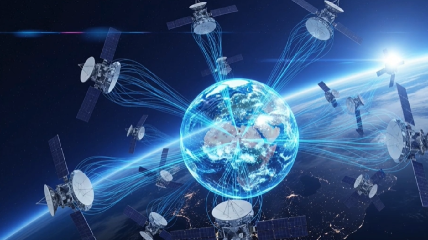
Synthetic aperture radar technology is changing how we see the world by making it possible to capture clear images even through clouds and darkness, and in this article you will understand how it works, why it matters, and where it is used in real life.
High Resolution Imaging Through Clouds and Darkness
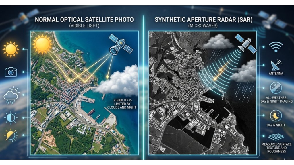
Synthetic aperture radar technology has become one of the most useful ways to observe the Earth when ordinary cameras cannot provide a clear view. Optical satellites depend on reflected sunlight, which means clouds, darkness, smoke, and poor weather can limit what they capture. SAR takes a different approach. It carries its own source of illumination in the form of radio waves, allowing it to collect information during both day and night.
Here is the simplest way to understand it. A SAR satellite sends radar signals toward the Earth’s surface and measures the signals that return. The returned energy contains information about the shape, roughness, moisture, and structure of the surface. Sophisticated processing then turns those measurements into an image that analysts can study.
This difference is more important than it may initially appear. A conventional satellite photograph can show what a landscape looks like under suitable conditions. SAR can reveal how that landscape behaves and changes even when visibility is poor. That makes it valuable for flood mapping, infrastructure monitoring, agriculture, environmental observation, disaster assessment, and security operations.
From my perspective, SAR is one of the technologies that deserves more public attention because much of its value remains invisible to ordinary users. People may see a satellite image online without realizing that radar satellites are collecting another layer of information beneath the visual surface.
How Synthetic Aperture Radar Works
The easiest way to understand SAR is to think about sending a signal toward an object and carefully studying its return. A satellite moves along its orbit while its radar system repeatedly transmits pulses toward the ground. When those pulses encounter buildings, vegetation, soil, water, roads, mountains, and other surfaces, some of the energy is reflected back toward the satellite.
The radar records the strength and timing of these returning signals. Instead of relying on a single observation from one physical antenna position, SAR processing combines measurements collected as the satellite travels. This movement creates what engineers call a synthetic aperture. The result is an imaging capability that can achieve much finer spatial detail than the physical antenna alone would suggest.
The process involves considerably more mathematics than a normal photograph. The system must account for the satellite’s position, the timing of the radar pulses, the phase of the returning signals, and the relationship between the radar and the observed surface. Advanced processing algorithms then reconstruct the observations into an image.
This is also why SAR images can look strange to people who are familiar with ordinary photography. A SAR image does not simply reproduce the natural colors of a landscape. Instead, it represents how different surfaces interact with radar energy.
Smooth water, for example, can appear very dark when radar energy is reflected away from the satellite. Buildings and other structures can produce strong returns and appear much brighter. Vegetation creates patterns influenced by its structure and moisture. The interpretation therefore requires a different way of thinking.
The important point is that SAR is not simply a camera operating at night. It is a sensing system that measures physical properties of the Earth’s surface through radar interactions.
Why SAR Can Operate Through Clouds
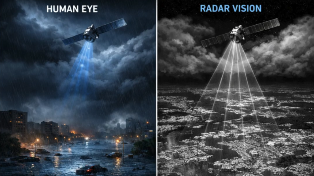
One of the biggest advantages of synthetic aperture radar technology is its ability to operate in conditions that restrict optical imaging. Most SAR systems use microwave wavelengths, which can pass through clouds and are far less dependent on visible light.
The importance of this increases significantly during severe weather.
A radar satellite can still collect observations.
The resulting information can help identify areas covered by water and support assessments of how far flooding has spread. When SAR observations are compared with earlier observations, analysts can also identify changes across the affected landscape.
Its usefulness goes well beyond dealing with floods.
This does not mean SAR completely ignores the atmosphere. Radar signals can still be affected by atmospheric conditions, and different wavelengths behave differently. However, SAR provides a major operational advantage because ordinary cloud cover does not simply make the observation impossible.
What Makes SAR Images Different From Normal Satellite Photos
A normal satellite photograph is intuitive because humans are accustomed to seeing the world through visible light. Trees look green, roads look gray, water often appears blue or dark, and buildings have recognizable shapes.
SAR images require another interpretation.
The brightness of a SAR image is related to the radar energy returned toward the sensor. Surface texture, geometry, moisture, orientation, and material properties can all influence that return.
A flat surface can behave very differently from a rough surface. A building can create a strong radar response because of its shape and relationship with the radar signal. Vegetation can produce complex scattering because leaves, branches, trunks, and moisture interact with the radar waves.
This is one reason SAR analysts receive specialized training. The image contains valuable information, but understanding that information requires knowledge of radar behavior.
In practical terms, SAR should not be viewed as a replacement for optical imagery. The two technologies often work better together. Optical imagery can provide an intuitive visual representation of a location, while SAR can provide information that remains available when lighting and weather conditions become difficult.
Why SAR Technology Matters Today
Modern societies depend on timely information about the Earth’s surface. Governments need to understand changing conditions. Emergency agencies need rapid assessments after disasters. Farmers need information about crops and soil conditions. Infrastructure operators need to know whether structures and surrounding land are changing.
SAR can contribute to all of these areas.
Its greatest strength is not simply that it can see at night. Its real strength is consistency. A monitoring system becomes much more useful when it can repeatedly observe an area under different environmental conditions.
Consider a bridge located near a river. A single image may tell an engineer what the bridge looks like. A sequence of radar observations can provide information about subtle surface movement over time. Specialized interferometric SAR techniques can detect changes in the distance between the satellite and the ground with remarkable sensitivity.
That does not mean SAR automatically diagnoses a structural problem. Engineers still need ground measurements, structural knowledge, and other evidence. However, radar observations can provide an additional monitoring layer that helps identify areas deserving closer inspection.
The same principle applies to land movement. If the ground around an urban area is gradually subsiding, repeated SAR observations can help scientists identify patterns that might be difficult to recognize from occasional visual images.
This is where SAR becomes more than an imaging technology. It becomes a method for monitoring change.
Real World Applications of SAR Technology
Synthetic aperture radar technology has applications across several sectors because the underlying sensing capability can be adapted to different problems.
In agriculture, radar observations can provide information about vegetation and surface conditions. Certain SAR measurements can also support the estimation of soil moisture. This can help agricultural specialists understand field conditions and make more informed irrigation decisions.
The practical benefit is straightforward. Water is an increasingly important resource, and applying the right amount of irrigation at the right time can reduce unnecessary consumption. SAR data does not replace farmers’ experience or field measurements, but it can give them another source of information when managing large areas.
In disaster management, the value can be even more immediate. After a flood, SAR can help distinguish flooded areas from surrounding land. Emergency organizations can use this information to understand the scale of an event and prioritize assessments.
After earthquakes, radar data can also contribute to the analysis of surface deformation. When SAR observations from different dates are processed using interferometric techniques, scientists can detect changes in the Earth’s surface.
Landslide monitoring is another important application. A slope may move gradually before a major failure. Repeated observations can help researchers identify movement patterns and potentially support risk assessment.
In environmental monitoring, SAR can contribute to studies of forests, wetlands, glaciers, coastlines, and other landscapes. Because radar interacts with vegetation and surface structure differently from visible light, it can provide complementary information that optical systems may not capture.
In urban environments, SAR can support monitoring of construction, land subsidence, and changes around buildings and transportation infrastructure. Cities are constantly changing, and repeated radar observations can help analysts understand those changes over time.
The Role of SAR in Disaster Response
Disasters demonstrate why dependable Earth observation matters.
When a major event occurs, decision-makers rarely have the luxury of waiting for perfect weather. They need information quickly. Roads may be blocked, communications may be damaged, and ground teams may be unable to reach affected areas.
Satellite radar can provide an important remote perspective.
For example, after widespread flooding, analysts can compare new SAR observations with earlier data. Water-covered areas often produce a distinct radar response, allowing analysts to create flood extent maps. These maps can support emergency planning and help identify potentially isolated communities and infrastructure.
The technology does not perform the rescue itself. The real benefit comes from helping improve awareness of the situation as it develops.
That distinction is important. Satellite data becomes useful when it reaches people and systems capable of making decisions with it. The real strength of SAR therefore lies not only in the satellite but also in the processing, interpretation, communication, and operational workflows surrounding the data.
How SIGINT from Orbit is Changing Global Intelligence
SAR and Artificial Intelligence
AI is becoming increasingly important in the way large volumes of SAR data are processed and interpreted.
A modern radar satellite can generate enormous quantities of information. Human analysts cannot manually inspect every observation with equal attention. AI-based systems can help identify patterns, classify land features, detect changes, and prioritize observations for further examination.
For example, an AI model can be trained to distinguish between different surface patterns in SAR imagery. Depending on the application and quality of training data, machine learning can assist with flood mapping, land-cover classification, infrastructure monitoring, and change detection.
AI can also help reduce the time between data collection and useful information.
This matters because raw radar data is not always immediately understandable to a decision-maker. A disaster-response team does not necessarily need to study the technical details of every radar return. It may need a clear map showing where flooding has expanded since the previous observation.
AI can help transform complex data into operational information.
Even when AI appears reliable, its output should not be accepted without human judgment.
For high-consequence decisions, AI-generated findings should therefore be validated through expert analysis and, where possible, additional sources.
In my view, the strongest future model is not SAR replacing humans or AI replacing analysts. It is SAR providing rich observations, AI helping process them at scale, and experts making the final interpretation.
SAR and Infrastructure Monitoring
Infrastructure is another area where SAR can provide valuable information.
Large structures and surrounding ground can experience small movements over time. These changes may be associated with natural processes, construction, groundwater conditions, or other factors. Detecting such movement early can help engineers investigate potential problems before they become more serious.
Interferometric SAR, commonly called InSAR, is particularly important here. It compares the phase information from radar observations acquired at different times. Under suitable conditions, these comparisons can reveal very small changes in the relative position of the ground.
This technology has been used to study land subsidence in cities, volcanic activity, earthquake-related deformation, and other surface changes.
The important practical lesson is that monitoring does not always require physically placing a sensor on every part of a landscape. Satellite radar can provide a wide-area measurement capability that complements ground-based instruments.
For large cities and infrastructure networks, that broad perspective can be extremely valuable.
SAR in Agriculture and Food Security
Agriculture is increasingly becoming a data-driven industry, and SAR has an important role to play.
Optical imagery can provide detailed information about crop appearance, but clouds can interrupt observations during important growing periods. SAR offers another way to monitor agricultural land because radar observations can continue when optical imaging is restricted.
Changes in radar response can provide clues about crop development, field conditions, and surface moisture. When combined with weather information, optical imagery, field observations, and other datasets, SAR can contribute to more informed agricultural decisions.
The larger issue is food security.
Agricultural monitoring is not only about helping an individual farmer decide when to irrigate. At a larger scale, satellite observations can support assessments of agricultural conditions across wide regions. Governments, researchers, insurers, and agricultural organizations can use Earth observation data to understand changing conditions.
This does not guarantee better harvests. Farming remains dependent on many variables, including weather, soil, crop selection, pests, and management practices. SAR is one tool within a much larger system.
SAR for Environmental Monitoring
The Earth’s surface is constantly changing, and many of those changes happen gradually.
Glaciers move. Forests are cleared or restored. Coastlines shift. Wetlands expand and contract. Ground levels rise or fall. Monitoring these processes requires repeated observations over time.
SAR is particularly useful because it can return to the same regions and provide observations under conditions that might challenge optical systems.
For scientists, the value comes from the ability to compare observations across time. Instead of asking only what a landscape looks like today, researchers can ask how it has changed over weeks, months, or years.
This temporal perspective is essential for understanding environmental processes.
When SAR data is combined with optical imagery and other scientific measurements, researchers can develop a much richer picture of environmental change.
SAR in Security and Defense
SAR also has important applications in security and defense because reliable observation is valuable when visibility is limited.
Radar satellites can support wide-area surveillance and monitoring without depending on daylight or clear skies. This can make them useful for observing remote regions, transportation networks, maritime environments, and other areas of interest.
However, SAR should not be understood as an all-seeing technology. Radar observations have limitations, and interpretation can be complicated by terrain, geometry, vegetation, and other factors.
For defense organizations, the greatest value often comes from combining SAR with other intelligence sources. Optical imagery, signals intelligence, geospatial information, and other sensors can provide different pieces of the same operational picture.
From my perspective, this multi-sensor approach is more important than treating any individual satellite technology as a complete solution.
SAR Versus Traditional Optical Imaging
The comparison between SAR and optical imaging is not really a question of which technology is universally better. Each system measures different things and performs better under different conditions.
Optical satellites are excellent when clear visual information is needed. Their imagery is intuitive and can be easier for people to interpret.
SAR offers a different advantage. It can operate independently of sunlight and can collect observations through cloud cover. It also provides information about surface characteristics and changes that may not be obvious in ordinary photographs.
The best results often come from using both.
For example, an analyst studying a damaged urban area might use optical imagery to visually inspect buildings and SAR observations to investigate changes in the surrounding surface. Combining the two datasets can create a more complete understanding than relying on either one alone.
The Advantages of Synthetic Aperture Radar
The strongest advantage of SAR is operational reliability. The ability to collect data during both day and night makes it particularly useful for continuous monitoring.
Another major advantage is its sensitivity to surface change. With appropriate techniques, SAR can reveal subtle deformation that may be difficult to identify through conventional photography.
Wide-area observation is another strength. Satellite radar can monitor large regions without requiring a physical presence on the ground.
SAR also provides flexibility because different radar frequencies and imaging modes can be selected for different applications. This allows systems to be designed around particular scientific, commercial, or operational requirements.
Perhaps most importantly, SAR creates a long-term record. Repeated observations can help researchers understand not only what is happening but how conditions are changing.
That time dimension can be extremely valuable.
Challenges and Limitations of SAR
Despite its capabilities, SAR is not a magic solution.
One of its biggest challenges is interpretation. A SAR image can contain information that is difficult for an inexperienced observer to understand. Bright and dark patterns do not necessarily correspond to familiar visual objects in the way they would in an ordinary photograph.
Specialized processing is often necessary, particularly for advanced applications such as interferometry.
Data volume is another challenge. Satellite radar systems can generate large datasets that require significant storage, processing capacity, and efficient analysis workflows.
Cost can also remain an issue. Designing, launching, operating, and maintaining sophisticated Earth observation satellites requires substantial technical and financial resources.
There are also physical limitations. Radar observations can experience effects such as geometric distortions, shadowing, layover, and speckle. The usefulness of a particular observation depends on the radar wavelength, viewing geometry, terrain, sensor characteristics, and application.
These limitations do not reduce the importance of SAR. They simply show why responsible interpretation matters.
A strong SAR workflow combines good data, appropriate processing, expert knowledge, and independent validation.
The Future of Synthetic Aperture Radar Technology
The future of synthetic aperture radar technology will likely be shaped by the combination of better sensors, more frequent observations, cloud-based processing, and AI-assisted analysis.
Satellite constellations can increase the frequency with which specific regions are observed. More frequent observations can make it easier to monitor rapidly changing situations.
AI can then help process the resulting data at scale.
This combination could make radar information more accessible to organizations that previously lacked the technical resources to work with complex SAR datasets. Instead of requiring every user to become a radar specialist, future platforms may provide simpler interfaces that convert complicated observations into practical information.
The development of smaller satellites and improved sensor technology may also support broader access to radar-based Earth observation.
However, the future should not be measured only by how much data satellites can collect. The real question is whether that data becomes useful information.
A thousand additional images do not automatically create better decisions. Better algorithms, reliable data infrastructure, skilled analysts, and clear operational goals are equally important.
Why SAR Matters for Everyday Life
It may seem that synthetic aperture radar technology belongs entirely to the world of satellites, scientists, and defense organizations. In reality, its effects can reach ordinary communities.
When satellite observations help map a flood, people can receive better emergency support. When radar data contributes to agricultural monitoring, farmers can make more informed decisions about valuable resources. When land movement is detected around infrastructure, engineers can investigate potential problems.
These benefits may never be visible to the average person.
That is precisely why SAR deserves attention. Some of the most important technologies are not the ones people interact with directly. They are the systems working quietly behind better decisions.
From my perspective, SAR represents a broader shift in how humanity observes the planet. We are moving from occasional snapshots toward continuous, data-rich monitoring.
That shift has enormous potential.
Practical Ways Organizations Can Use SAR More Effectively
Organizations considering SAR should begin with the problem rather than the technology.
The first step is to identify what needs to be monitored. Is the goal flood mapping, infrastructure movement, agricultural analysis, environmental observation, or another application? Once the objective is clear, the appropriate radar data and processing approach become easier to determine.
The next step is to combine SAR with other information sources. Optical imagery, weather information, geographic datasets, ground sensors, and expert observations can all improve interpretation.
Organizations should also invest in people. Sophisticated satellite data is only useful when teams understand how to interpret it and recognize its limitations.
Finally, AI should be introduced where it provides a measurable benefit. Automating repetitive analysis can save time, but automated outputs should be tested and validated before they become part of critical decision-making.
This practical approach can prevent organizations from buying technology simply because it is advanced. The goal should always be better information and better decisions.
What Synthetic Aperture Radar Means for the Future
Synthetic aperture radar technology is changing the relationship between satellites and the Earth.
Instead of waiting for sunlight and clear skies, radar satellites can actively observe the surface under a much broader range of conditions. Instead of relying only on visual appearance, analysts can study surface characteristics, movement, and changes over time.
The combination of SAR, AI, improved satellite constellations, and advanced data processing could make Earth observation faster and more useful than ever.
But the technology should remain grounded in practical needs. The most valuable radar system is not necessarily the one producing the most impressive technical specifications. It is the one providing reliable information that helps people understand a real problem.
Synthetic aperture radar technology has already demonstrated its value across agriculture, disaster response, environmental monitoring, infrastructure analysis, and security. Its future importance will likely come from how effectively these capabilities are connected.
At Worldstan, we believe advanced technology becomes truly valuable when people can understand what it does and why it matters. SAR is a perfect example. Behind every radar image is a complex combination of satellites, radio waves, signal processing, mathematics, and human expertise. Yet the purpose remains simple: to help us observe a changing planet more reliably.
Synthetic aperture radar technology is not simply another way to take pictures of Earth. It is a powerful sensing method that gives us a different understanding of the world, especially when conventional imaging reaches its limits. As AI and satellite systems continue to improve, SAR can become an even more important part of how governments, scientists, businesses, and communities monitor change and make informed decisions.
Exclusive Insight from Worldstan
At Worldstan, we focus on breaking down complex technologies into clear, practical understanding. This discussion is not just about explaining SAR, it is about helping you see its real-world value.
From my perspective, platforms that simplify advanced topics are shaping a more informed future. That is exactly what Worldstan aims to deliver.
Synthetic aperture radar technology is not just another scientific advancement, it is a powerful tool that is quietly transforming how we understand and manage the world. Its ability to see through clouds and darkness makes it reliable in situations where other systems fail. From agriculture to disaster response, its impact is both practical and meaningful. In my view, as technology continues to evolve, SAR will play an even bigger role in shaping smarter decisions and safer communities.